Friday, December 28, 2007

Top 5 Weather Moments of 2007


Wow, what a year it has been. The weather changes so much around here, it's hard to remember the major weather anomalies that occur during the year. Luckily, the meteorologists at the National Weather Service in Blacksburg have a computer-like memory.

Obviously, the drought was one of the main weather stories this year. We're starting 2008 with a deficit of 10 inches in Roanoke. Almost as bad in other areas. But that wasn't all that happened in the world of weather.

Below is the list of "Top Five Weather Events in 2007" as voted on by meteorologists at the National Weather Service office in Blacksburg. NOTE: These are LOCAL events, not national ones. Thanks guys/gals for compiling this list! --Brent

---------------------------------------------------------

1. DROUGHT. DROUGHT CONDITIONS ARRIVED IN MAY AND WORSENED TO D4...OR EXCEPTIONAL...INTENSITY IN NORTHWEST NORTH CAROLINA AND PORTIONS OF SOUTHWEST VIRGINIA. DANVILLE EXPERIENCED THE SECOND DRIEST MAY ON RECORD AND THE DRIEST AUGUST ON RECORD WAS NOTED IN DANVILLE AND BLUEFIELD. NOVEMBER WAS THE DRIEST MONTH ON RECORD IN
ROANOKE. ESTIMATED DAMAGE FROM THIS DROUGHT IN OUR FORECAST AREA IS ALREADY IN THE TENS OF MILLIONS OF DOLLARS.

2. JANUARY 1ST FLOODING. THE FOURTH HIGHEST CREST ON RECORD FOR THE DAN RIVER OCCURRED IN DANVILLE AND 27 ROADS WERE CLOSED ACROSS PITTSYLVANIA COUNTY. ROADS WERE ALSO FLOODED IN HALIFAX AND HENRY COUNTIES.

3. RECORD HEAT. ROANOKE, BLUEFIELD, AND BLACKSBURG ALL SET RECORDS FOR THE WARMEST AUGUST ON RECORD IN 2007 WITH DANVILLE REACHING THE SECOND WARMEST AUGUST ON RECORD. SEPTEMBER 2007 WAS THE HOTTEST ON RECORD AT BLUEFIELD AND THE FIFTH HOTTEST AT
BLACKSBURG...THE SIXTH WARMEST AND ROANOKE AND THE NINTH WARMEST AT DANVILLE. ROANOKE...BLUEFIELD...DANVILLE AND BLACKSBURG ALL EXPERIENCED THEIR SECOND HOTTEST OCTOBER ON RECORD IN 2007 WITH LYNCHBURG EXPERIENCING THEIR NINTH WARMEST OCTOBER.

4. APRIL FREEZE. TWO TO FOUR CONSECUTIVE DAYS OF SUB FREEZING LOW TEMPERATURES WERE OBSERVED FROM APRIL 6TH THROUGH THE 9TH AFTER A PERIOD OF RELATIVELY MILD WEATHER IN LATE MARCH AND VERY EARLY APRIL. THIS RESULTED IN SIGNIFICANT CROP DAMAGE WITH LOSSES
ESTIMATED IN THE TENS OF MILLIONS OF DOLLARS.


TIE 5. FEBRUARY 13TH AND 14TH ICE STORM. ICE ACCRETIONS RANGED FROM ONE QUARTER TO ONE HALF INCH...WITH UP TO AN INCH AND A QUARTER OF ICE ON THE BLUE RIDGE PARKWAY IN FLOYD COUNTY. THE ICE BROUGHT TREE LIMBS DOWN AND SCATTERED POWER OUTAGES.

TIE 5. AUGUST 21ST SEVERE WEATHER EVENT. NUMEROUS THUNDERSTORMS DEVELOPED ACROSS THE AREA. SOME OF THESE STORMS WERE SEVERE WITH DAMAGING WINDS AND LARGE HAIL. THERE WERE 39 SEVERE WEATHER EVENTS ASSOCIATED WITH THIS OUTBREAK...WHICH WAS THE GREATEST NUMBER FOR ONE EVENT IN OUR FORECAST AREA IN 2007.

Source: National Weather Service - Blackburg Forecast Office

Monday, December 17, 2007

Chances of a White Christmas?

Rarely ever does it snow in southwest Virginia on Christmas Day, but we have had some years where snow was still on the ground for the big day.

The folks from the National Weather Service, Blacksburg have done some tabulating and found that, climatologically, there's a 17% chance Roanoke would have an inch of snow on the ground for Christmas. Here's their breakdown for other parts of the region.

LYNCHBURG 13%
NORFOLK 3%
RICHMOND 7%
ROANOKE 17%
VIRGINIA BEACH 0%

How about the snowiest Christmases?
Roanoke (1948-2006): 1) 14.6 inches in 1969
Lynchburg (1893-2006)1) 9.9 inches in 1969
Danville (1948-2006)1) 1.0 inch in 1976
Blacksburg (1952-2006)1) 6.0 inches in 1962

If you'd like to assure yourself a white Christmas, you could build a homemade snow machine like the ski resorts use. Or, you could hire a company to do it for you. Get this...

The folks at Magic Snow can make "Dreaming of a White Christmas" a reality. MagicSnow creates the illusion of a realistic snowfall, indoors or out.

The company calls it the "self-cleaning" snow that vanishes upon contact. Snow falls on cue and disappears like magic.
(Photo Left: MagicSnow falling at Dolphin Mall in Miami)

It's amazing the lengths people would go to to have snow on Christmas Day.

I know someone (I won't mention any names...Leo Hirsbrunner) who was going to buy their own snow-maker to cover the ground in white. Wouldn't that puzzle the neighbors. It only snowed at Leo's house.

Now that would be a great Christmas present!

Happy Holiday, --Brent

Tuesday, December 4, 2007

Winter Weather Preparedness Week


While we don't get hit with frequent winter storms like some parts of the country, it only takes one major storm to cause an inconvenience, even death.

This is Winter Weather Preparedness Week in the state of Virginia. With a clipper system headed our way Wednesday, I thought I'd share some information the National Weather Service sent out about the topic.

THE ALBERTA CLIPPER.

DURING MOST WINTERS...A LARGE POLAR VORTEX ESTABLISHES ITSELF OVER
HUDSON BAY CANADA...AND EXTENDS ITS INFLUENCE SOUTHWARD INTO THE
CENTRAL AND EASTERN PARTS OF THE U.S.. SMALLER SCALE LOW PRESSURE
AREAS BECOME EMBEDDED IN THE LARGE CIRCULATION AROUND THE POLAR
VORTEX AND DROP SOUTHEASTWARD INTO THE U.S. FROM THE CANADIAN
PRAIRIE PROVINCES OF ALBERTA AND SASKATCHEWAN.

APPROPRIATELY TERMED "ALBERTA CLIPPERS"...THESE FAST MOVING STORM
SYSTEMS USUALLY PRECEDE A SURGE OF COLD POLAR OR ARCTIC AIR...AND
CAN PRODUCE BURSTS OF SIGNIFICANT SNOW ALONG WITH STRONG WINDS. IN
MOST INSTANCES...ALBERTA CLIPPERS PRODUCE LIMITED PRECIPITATION IN
OUR AREA DUE TO THEIR FAST MOVEMENT AND INABILITY TO TAP
MOISTURE FROM EITHER THE ATLANTIC OCEAN OR GULF OF MEXICO.

WHEN SNOW OCCURS WITH AN ALBERTA CLIPPER...IT IS USUALLY ON THE ORDER OF
A DUSTING TO FOUR INCHES...OR A "NUISANCE" SNOW. HOWEVER...IF THE POLAR
VORTEX IS STRONG ENOUGH...AND ITS INFLUENCE EXTENDS SOUTHWARD INTO THE
DEEP SOUTH...STRONG ALBERTA CLIPPERS CAN BECOME MAJOR WEATHER EVENTS
FOR OUR AREA.

IN THESE SITUATIONS...THE ALBERTA CLIPPER TAPS THE AVAILABLE MOISTURE
SOURCES FROM THE ATLANTIC OCEAN AND GULF OF MEXICO. THE SURFACE LOW
REDEVELOPS AND INTENSIFIES NEAR THE MID OR SOUTH ATLANTIC COAST...AND
BECOMES A FULL BLOWN NOR'EASTER. THE ENSUING NOR'EASTER SPREADS SNOW...
SOMETIMES RAIN NEAR THE COAST...AND STRONG WINDS UP THE EAST COAST...
PRODUCING MAJOR TRAVEL PROBLEMS

UP TO DATE WEATHER INFORMATION IS AVAILABLE AT:
WWW.WEATHER.GOV/BLACKSBURG

THE NATIONAL WEATHER SERVICE WINTER WEATHER AWARENESS HOME PAGE IS FOUND
HERE:
WWW.NWS.NOAA.GOV/OM/WINTER/INDEX.SHTML

Thursday, November 29, 2007

2007 Hurricane Season Ends Quietly


This Friday (Nov 30) marks the end of the 2007 Atlantic Hurricane Season. And, for the second year in a row, expert predictions for an above normal season turned out to be a bit too high.

A total of 14 named storms, including 6 hurricanes developed in 2007, making this an "average" season for the Atlantic Basin.

Only 1 weak hurricane, and several tropical storms struck the United States. A far cry from the 2005 season that spawned hurricanes like Katrina and Rita.

But this season did bring about some stronger storms, most of which impacted impoverished and vulnerable nations in the Caribbean and Central America.

Hurricanes Dean and Felix ramped up to Category Five status, the highest on the intensity scale. Dean and Felix were also the first two Atlantic hurricanes since records began in 1851 to make landfall in the same season as Category Five storms.

Hurricane Humberto also became the fastest developing storm on record to be so close to land. It strengthened from a 35 mph tropical depression to an 90 mph hurricane in 14 hours while only 15 miles off the coast of Texas.

Why so fewer hurricanes than expected? Former National Hurricane Center Director Max Mayfield told the Miami Herald, "the past several years have humbled the seasonal hurricane forecasters," and pointed out there's a long way to go in the science of hurricane prediction.

So as the season comes to a close, remember, it's simply a date. While hurricanes have formed after the "end" of the season, it appears unlikely this year.

Count your blessings Dean and Felix stayed away from the United States. However, southwest Virginia will likely feel the effects from the lack of tropical rain this season, well into the start of next year's season.

View the entire hurricane season tracks and facts.

--Brent

Sunday, November 18, 2007

Thanksgiving Forecast

In the pre-Thanksgiving rush, we have posted an early weather report from our meteorologists.

Turkeys will thaw in the morning, then warm in the oven to an afternoon high near 190F. The kitchen will turn hot and humid, and if you bother the cook, be ready for a severe squall or cold shoulder.

During the late afternoon and evening, the cold front of a knife will slice through the turkey, causing an accumulation of one to two inches on plates. Mashed potatoes will drift across one side while cranberry sauce creates slippery spots on the other. Please pass the gravy.

A weight watch and indigestion warning have been issued for the entire area, with increased stuffiness around the beltway. During the evening, the turkey will diminish and taper off to leftovers, dropping to a low of 34F in the refrigerator.

Looking ahead to Friday and Saturday, high pressure to eat sandwiches will be established. Flurries of leftovers can be expected both days with a 50 percent chance of scattered soup late in the day. We expect a warming trend where soup develops. By early next week, eating pressure will be low as the only wish left will be the bone.

(This one's been around for a while, but I thought it fit in well with the festivities.) Hope you and your family have a great Thanksgiving!

Monday, November 12, 2007

Homemade Lightning

This is the coolest thing. We had a story about Tesla coils on the news last night. A Tesla coil is a type of resonant transformer, named after its inventor, Nikola Tesla. He used these coils to perform many electrical experiments.

In fact, you use many of Tesla's "experiments" today. There's fluorescent lighting, alternating current used in your car, and the coil is still used in radio and television sets and other electronic equipment.

This guy in Oklahoma has created a giant Tesla coil and creates a lightning storm in his backyard every night. This guy is insane!


Now, here's a crazy guy who rigged a Tesla coil up to his MIDI keyboard. He obviously has way too much time on his hands.

Wednesday, November 7, 2007

Comet Holmes UPDATE!

John Goss from the Roanoke Valley Astronomical Society joined us in-studio Wednesday with details on the Comet Holmes. Here's a little background information.

Comet Holmes was discovered in 1892 by Edwin Holmes, in London England, and it was very faint. In fact, about 25,000 times fainter than the faintest star that can normally be seen without any optical aid. In order to view an object this faint, one would need a moderately large telescope. Last month, the comet suddenly brightened nearly 400,000-times in less than 24-hours! Comet Holmes is not as dramatic as some, lacking the characteristic tail.


See an interactive look at comets through time.

--Meteorologist Brent Watts

Friday, November 2, 2007

October Warmest and Wettest for Some

We did it again! Another warmer than normal month. While it wasn't the warmest ever, it was close in some areas. Here's the breakdown from the National Weather Service office in Blacksburg.

Warm Weather Summary
-ROANOKE...DANVILLE...BLACKSBURG AND BLUEFIELD RECORDED THEIR
SECOND WARMEST AVERAGE TEMPERATURES ON RECORD FOR THE MONTH OF OCTOBER.

FOR ROANOKE...THE AVERAGE TEMPERATURE FOR OCTOBER 2007 WAS 63.5
DEGREES. THE RECORD WARMEST OCTOBER WAS IN 1984 AT 64.3 DEGREES.
RECORDS IN ROANOKE DATE BACK TO 1948.

IN DANVILLE...THE AVERAGE TEMPERATURE FOR OCTOBER 2007 WAS 65.2
DEGREES. THE RECORD WARMEST OCTOBER WAS IN 1984 AT 66.5 DEGREES.
RECORDS IN DANVILLE DATE BACK TO 1948.

IN BLACKSBURG...THE AVERAGE TEMPERATURE FOR OCTOBER 2007 WAS 59.0
DEGREES. THE RECORD WARMEST OCTOBER WAS IN 1984 AT 60.4 DEGREES.
RECORDS FOR BLACKSBURG DATA BACK TO 1952.

AT BLUEFIELD...THE AVERAGE TEMPERATURE FOR OCTOBER 2007 WAS 62.4
DEGREES. THE RECORD WARMEST OCTOBER WAS IN 1984 AT 63.9 DEGREES.
RECORDS FOR BLUEFIELD DATE BACK TO 1959.

AT LYNCHBURG...THE AVERAGE TEMPERATURE FOR OCTOBER 2007 WAS 61.8
DEGREES WHICH IS 7TH WARMEST ON RECORD. THE WARMEST OCTOBER FOR
LYNCHBURG WAS IN 1984 AT 65.5 DEGREES. RECORDS FOR LYNCHBURG DATE
BACK TO 1893.

Despite Drought, Some Areas See Wettest October Ever.

DESPITE BEING IN A DROUGHT DURING OCTOBER...THE HEAVY RAIN THAT
FELL IN THE LATTER PART OF THE MONTH ACTUALLY PUT ALL BUT
LYNCHBURG IN THE TOP 10 FOR WETTEST OCTOBERS ON RECORD.

ROANOKE RECORDED 5.33 INCHES OF PRECIPITATION...WHICH IS 10TH ALL
TIME FOR OCTOBER.

DANVILLE RECORDED 6.35 INCHES OF PRECIPITATION...WHICH IS 7TH ALL TIME FOR OCTOBER.

BLACKSBURG RECORDED 4.91 INCHES OF PRECIPITATION...WHICH IS 8TH
ALL TIME FOR OCTOBER.

BLUEFIELD RECORDED 4.73 INCHES OF PRECIPITATION...WHICH IS 7TH
ALL TIME FOR OCTOBER.

DESPITE RECORDING 4.97 INCHES OF PRECIPITATION FOR OCTOBER
2007...THIS WAS 20TH ALL TIME FOR LYNCHBURG.

***data compiled and released by the National Weather Service in Blacksburg, VA
------------------------
--Meteorologist Brent Watts

Monday, October 29, 2007

Comet Holmes Lights Night Sky

There's a new comet in the night sky, Holmes. It's 150 million miles away, but is putting on a show over the past week.

Less than a week ago periodic Comet Holmes brightened dramatically — by nearly a million times — virtually overnight. This means all you need is some time and a pair of binoculars.

Best time to see comet is before moon rises. Holmes will look very similar to a bright star. And don't expect a tail. It appears the comet is too far away from the sun to form a tail (tail is created by the burning of the comet's gases from the sun's extreme heat).

While this comet will likely be around for weeks, Monday and Tuesday from 8-9pm will be the best times to see it. Just look in the northeast sky.

View Photos of Comet Holmes

Click here for the blog of the Roanoke Valley Astronomical Society


--Meteorologist Brent Watts

Thursday, October 25, 2007

Doppler Indicated Tornado?


In the days of warning you sooner than ever about tornadoes, there's also going to be some "crying wolf" syndrome. That came in the form of a couple emails from folks that didn't quite understand the concept of doppler indicated tornado warnings. On television, it's a bit difficult to explain radial velocity and TVS's to the average viewer, but let's give it a shot here.

Wednesday's tornado warnings were doppler radar indicated. This meant the radar was looking at wind velocity, coming toward and away from the radar, and detected twisting winds within the cloud. This twisting is the first sign a tornado is forming. Once the winds begin twisting in the cloud, there's a chance it could make it to the ground. This is why we need to warn you.

Once this tornado signature has been detected by radar, the National Weather Service office in Blacksburg issues a Tornado Warning (meaning a tornado is likely or occurring).

You may say, "why warn us about a tornado that's not even on the ground?" Good question. Even if no tornado forms, this type of warning can save lives because if a tornado does form, the advanced warning gives you precious minutes to get yourself and your family to safety. If we waited for confirmation that a tornado had already touched down, someone may have lost their life. Not to mention, many tornadoes around here are rain-wrapped, meaning the funnel cloud is obscured by torrential rain.

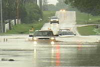
Luckily, no tornadoes touched down here Wednesday. They did seem to come from out of the blue. The twisting was likely caused by a passing front to our south and areas of low pressure riding along it. Looks like the mean threat over the next 48hrs will be flash flooding from heavy downpours.Stay safe, and remember "turn around, don't drown." NEVER drive through flooded roads. This could be YOU! --Meteorologist Brent Watts

Sunday, October 21, 2007

Autumn Color - Viewer Photos


Viewers have captured autumn's beauty through the lens of their digital cameras recently. It's certainly a beautiful time of the year as our fall foliage peaks. Send your best shot to our Viewer Scrapbook.

--SkyTracker7 Meteorologist Jay Webb

Monday, October 15, 2007

Welcome Eagle Rock Elementary School!


The WeatherBug is getting bigger and bigger thanks to great schools and businesses who are joining the network. The newest is Eagle Rock Elementary School in Botetourt County. What's fantastic is that this is one of the smallest schools in the county, but have managed to raise the money to bring weather and science into the classroom.

The school is located in the northwestern portion of Botetourt County. Welcome students, faculty and parents. We hope you will use the weather data to help plan your day and to broaden your knowledge of this amazing science of weather.

Click here for the Eagle Rock Elementary Live data.

Click here for Eagle Rock Elementary School homepage.

--Meteorologist Brent Watts

Tuesday, October 9, 2007

La Nina Means Mild Winter Weather.

NOAA forecasters are calling for above-average temperatures over most of the country and a continuation of drier-than-average conditions across already drought-stricken parts of the Southwest and Southeast in its winter outlook for the United States. The report was released Tuesday (Oct 9th) and paints a bleak picture for southwest Virginia.


Movie of sea surface temperatures, January 1, 2007 - October 3, 2007. Purple and blue colors represent lower-than-average sea surface temperatures.

It appears La Nina is to "blame" for the mild winter that is forecast for the south and mid-Atlantic. La Nina is marked by abnormally cool ocean water in the equatorial Pacific. You can read the full report/forecast here, but here are some of the highlights:

  • In the Northeast and the Mid-Atlantic,temperatures are expected to be above average in response to the long-term warming trend. Snowfall for the region will depend on other climate factors, which are difficult to anticipate more than one-to-two weeks in advance.
  • The drought-plagued Southeast is likely to remain drier-than-average due to La Niña, while temperatures are expected to be above average.

With this said, this certainly doesn't mean we won't see any snow. Also, despite forecasting above average temperatures, you can count on some very cold periods this winter. This is a forecast, an educated prediction of what will happen 2 to 4 months down the road. Don't let your snow shovels hibernate this winter. Chances are you'll need them at least once.

--Meteorologist Brent Watts

Learn more about La Nina

Thursday, October 4, 2007

Winter Weather Outlook


It's hard to think about winter when the temperatures outside have been in the 80s for much of the week. But if you're already dreaming of making snowballs and building snowmen, you might want a back-up plan.


While much of the nation is still in summer mode, the folks at the National Oceanic and Atmospheric Administration's Climate Prediction Center have been busy running models forecasting winter weather. What are they saying?


  • Long-range weather forecasts are predicting a warmer than average winter with less precipitation for much of the United States except the Pacific Northwest.

  • NOAA forecasters believe the emergence of a La Nina condition -- unusually cold ocean temperatures in the equatorial Pacific Ocean -- will be the main factor behind the anticipated warmth for much of North America.

If you remember, the winter of 2006-07 was extremely mild for southwest Virginia, with very little snowfall and record warmth in January. Roanoke only saw 3.4" of snowfall last winter, which fell in February. A typical winter would bring an average of 23 inches of snow to the Roanoke Valley.


I don't know about you, but I'd love to see us have a big winter with lots of snow. We need all the help we can get to make up for an extremely dry summer and fall.

--Brent

Monday, October 1, 2007

Ragweed Remediation

Early fall is prime time for allergies, and in Roanoke, ragweed is the primary allergen at work right now. Ragweed plants, which only live for one season, mature as nights get longer in late summer and early fall, releasing up to one billion pollen grains per plant!

Seventy-five percent of Americans who are allergic to pollen-producing plants are allergic to ragweed, of which there are seventeen different species growing throughout the United States.

There are easy ways to reduce your exposure to outdoor allergens, including ragweed:

1) Minimize your outdoor activity in the early morning (5-10am), when pollens are usually emitted, and avoid raking leaves or cutting grass, which can stir up pollens.

2)While it may be tempting to open windows on cool nights, keeping them closed can reduce pollen concentrations inside your home.

3)Keeping the air conditioner on can help filter and dry the air, which will also help to reduce exposure.

4)Don't hang laundry items outside to dry, where pollens and molds can collect on them.

Fun Fact: Ragweed pollens can travel considerable distances on breezy days - pollens have been found up to 400 miles out to sea, and two miles up in the atmosphere!

Learn more about the environment at earthguage.net

Can the sun be different sizes?


A recent question from a viewer is related to the sun's size, and could it possibly change sizes throughout the day:

Question: Why does the sun appear so much larger in the morning when it rises than in the middle of the day, and then gets large again when it sets? Could it change size during the day?

A: This apparent change in size of the sun and the moon is merely an illusion. While there are numerous competing theories to explain this illusion, most involve optical processes of viewing distant objects.

One way to convince yourself that the apparent change in size is merely an illusion is to do the famous finger test. Use the moon because it's dangerous to look directly at the sun. Just extend your arm and compare the size of the moon at its zenith (the highest peak) to a finger or thumbnail. Do the same when the moon is at the horizon. The moon will be the same size.

It's amazing how optics can fool you. In fact, I'm still searching to find the end of the rainbow to claim my pot of gold. :)~

For an interactive look at the sun go to this link: http://www.spaceweathercenter.org/SWOP/Interactives/1.html

Monday, September 24, 2007

Weather Radios Recalled


Just wanted to pass along some important weather information regarding NOAA Weather Radios. First off, anyone who receives alert signals from the Roanoke, Lynchburg, Hinton or Mount Jefferson transmitters will notice the radio broadcast will be off-the-air Tuesday, September 25th from 10am to 4pm.

The National Weather Service in Blacksburg will be conducting a computer software upgrade. Again, the radios should be back up by 4pm Tuesday.

NO severe weather is forecast for Tuesday, so the timing is impeccable. Nice job NWS Blacksburg!
-------------------------------------------

Also, weather radio manufacturer Oregon Scientific has recalled over 66,000 of their NOAA weather radios, as they fail to receive alert signals in certain areas of the country. Click the link below for model names.


Hope you have a great 1st week of autumn! --Brent

Saturday, September 22, 2007

Why I'm Not A Pilot

I love flying, and have a great appreciation for anyone who can take a piece of machinery and navigate it through an active atmosphere while at the same time knowing you have hundreds of people's lives in your hands. Just couldn't do it. Pilots have so many variables to deal with...wind, rain, storms, ice and fog. The video below shows a Boeing 737 landing in thick fog at London's Heathrow Airport without visibility. You can hear the computer instrumentation guiding the pilot through the landing process. Amazing to see!


There are many rules when it comes to flying an aircraft under certain weather conditions. Here's some of the lingo.

Visual Flight Rules (VFR) - the pilot has the responsibility for seeing and avoiding other aircrft, towers, mountains, etc.

Marginal Visual Flight Rules (MVFR) - conditions between VFR and IFR. Generally defined as visibility between 3 and 5 miles, and ceilings between 1,000 and 3,000 feet.

Instrument Flight Rules (IFR) - the pilot may be in clouds, flying solely by instruments, and therefore unable to see other aircraft. The controller takes the responsibility for aircraft separation.

Low Instrument Flight Rules (LIFR) - ceiling below 500 feet AGL and/or visibility less than one mile.

Sounds like a topic for BTF. --Brent

Sunday, September 16, 2007

Humberto Brings Hope

The spanish meaning for Humberto is "bright." Sure enough, the rain from this record-setting storm brightened the spirits and the lawns of southwest and central Virginia. While not everyone received the 5-8 inch totals as Patrick and Henry counties did, everyone got at least some rainfall. Below are some of the rainfall reports from the National Weather Service in Blacksburg. These come from the IFlows automated rain gauge network. You can find a link to all these guages on our weather page, look under "Weather Extras" and click on "Rainfall Totals from area Gauges."

...PATRICK COUNTY...8.12" CIRCLE M IFLOWS

...HENRY COUNTY...
5.58" SMITH RIVER SG

...ROANOKE...
1.44" MILL MOUNTAIN

...CITY OF DANVILLE...
1.63" DANVILLE

...BATH CO...
1.32" DOUTHAT ST PARK

...BOTETOURT CO...
1.00" DALEVILLE

Not only did this storm provide benefitial rain to areas in a moderate to extreme drought, it also made history. We have never seen a tropical depression intensify this rapidly into a hurricane just prior to making landfall. Here's the details from the National Hurricane Center:

"BASED ON OPERATIONAL ESTIMATES...HUMBERTO STRENGTHENED FROM A 30 KT (35 mph) DEPRESSION AT 15Z (10 am) YESTERDAY TO A 75 KT (85 mph) HURRICANE AT 09Z (4 am) THIS MORNING...AN INCREASE OF 45 KT (50 mph) IN 18 HOURS. TO PUT THIS DEVELOPMENT IN PERSPECTIVE...NO TROPICAL CYCLONE IN THE HISTORICAL RECORD HAS EVER REACHED THIS INTENSITY AT A FASTER RATE NEAR LANDFALL. IT WOULD BE NICE TO KNOW...SOMEDAY...WHY THIS HAPPENED."

Thanks Humberto for your rain, and we hope there are more where you came from. We have a long way to go to make up for what we've lost. Now I need to go mow my lawn. The first time since July!

--Brent

Wednesday, September 12, 2007

A Cool Find!

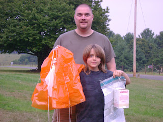
Every once in a while it'll happen. Someone out there will stumble upon a bright orange parachute with a cardboard box attached to it by lots of string.

On Monday, nine year old Devin Browder found such an object while walking in Hillsville on Hayfield Road. What he found was a weather balloon, which was launched by the National Weather Service. There are a few places this could've come from, including Morristown, TN, Charleston, WV, or likely Blacksburg. These weather instruments (called radiosondes) measure important weather aloft. Meteorologists gain valuable information like temperature, humidity, pressure and the wind profile of the atmosphere.

Weather balloons were first used by the U.S. Weather Bureau in 1936. They are launched twice daily from roughly 90 weather service offices around the country. The balloons are filled with Helium, and while they are big before the launch (around six feet in diameter) they get about as large as a two story house once the Helium interacts with cold air around 20 miles above the earth. Temperatures there are around -130 degrees Fahrenheit! Each radiosonde costs the government around $200 - and meteorologists at the NWS office in Blacksburg tell me they only get back around 2% - 4% of the balloons they launch every year. Devin didn't tell me if he plans on returning his balloon or not, but I bet it makes it to a few "show-and-tells" at his school this year. Thanks for sending us your photo Devin! --Jay

Saturday, September 8, 2007

Just Our Luck ~ No Rain

Even with a subtropical storm to our east, and a cold front loaded with moisture to our west, we're not getting a drop of rain this weekend. Instead, hot and humid weather will be the rule. The image above shows the zones of precipitation Sunday morning through Monday morning. As you can clearly see, the coastal Carolina's will pick up a few inches of rain courtesy of Subtropical Storm Gabrielle, and the front stretching from Maine to Texas will have areas of heavy rain. But just our luck, the sinking, dry air between the systems to our east and west will win out, which means more lawn watering (unless you're like me and you've given up on that!) The WDBJ7 DayPlanner offers a few rain chances next week. Thanks for checking out our weather blog! --Jay

Monday, September 3, 2007

Everything you need to know about weather!

Research shows the average viewer knows little about the atmospheric processes. As meteorologists, we try to put the complex world of weather forecasting into simple terms most people can understand. While it sounds like a simple task...it's not. So, as a crash course in weather, I'm requiring all my students to view this simple, yet educational video presentation.


This is actually Peter Weatherall's music video about the weather. He writes songs geared toward children. Peter was born in Australia, and grew up in England, the United States, and New Zealand and currently lives in Japan. So he knows his international weather. For more info on the weather song and Peter's music, visit www.kidsinglish.com

In the next class, we will examine the effect of coriolis force on vorticity covariance in MHD turbulent flow of dusty fluid.

--Brent

Tuesday, August 28, 2007

An August for the Record Books


There's no surprise August was an extremely hot month. But would you believe over 56 records were set this month? That's an astounding number of broken records. In fact, so odd, the National Weather Service office in Blacksburg compiled and released a list of August heat facts. Here's a summary.

+August 2007 will be the hottest on record for Roanoke, Blacksburg, Danville & Bluefield

+Over 56 records have been set for both high maximum and high minimum temperatures combined. (High minimum is considered the warmest low temperature for that date).

+There were numerous days 90+ degrees. Here's the breakdown by city: ROANOKE: 23 days
LYNCHBUG: 16 days
BLACKSBURG: 11 days
DANVILLE: 24 days

Total Lunar Eclipse

As the moon passed through the earth's shadow early this morning, few locally were able to see it. Clouds obstructed the view of the year's second Total Lunar Eclipse. For those that didn't get to see it, here's a look at the total eclipse that took place March 3rd of this year.


Aside from the clouds, a couple things got in the way of making this a spectacular viewing. The eclipse took place a bit too close to moonset OR sunrise (however you look at it). So, by the time the moon became totally immersed in the moon's shadow, the morning twilight interfered with its visibility. Also, the moon blended in with the clouds and haze we had in the atmosphere.

If you weren't able to see it this time, perhaps try next year. The next Total Lunar Eclipse will be February 20, 2008.

Meteorologist Brent Watts

Tuesday, August 21, 2007

Gustnado vs Tornado

Tuesday's severe storms that rolled through parts of the region created swirls of debris that appeared to resemble a tornado. Several folks reported seeing a funnel cloud. However, many weather features can create a tornado-like swirl. One of those is the gustnado.
A gustnado is a short-lived swirl of wind (whirlwind) that develops on a thunderstorm outflow boundary called a gust front.


Gustnados develop from the ground up as winds interact with land and begin to swirl, picking up dust and debris. The result is similar to a small tornado. However, if you're brave enough to look closely, you'll see the gustnado is not attached to the cumulonimbus cloud or related to the storms rotation, unlike its cousin the tornado.

It CAN produce damage due to its straight-line winds that can reach over 70mph. Gustnado damage is typically limited to small trees, windows and tossing around of loose objects, but can be worse in a very strong storm.

Thankfully, we're not accustomed to seeing these acts of nature in these parts very often. So, being able to differentiate between the two while finding shelter is fairly difficult. Regardless of the culprit, wind damage was reported and the daily plans were disrupted for a short period of time. Had this been a strong tornado, this may be a different story.

Send your weather questions to: bwatts@wdbj7.com

--Meteorologist Brent Watts

Space Station and Shuttle

Mark Hodges from the Science Museum of Western Virginia sent us this cool photo of the International Space Station and Shuttle Endeavor.

In his email he writes: "I shot this this evening at 9:30pm from the 5th floor parking deck at Center in the Square passing over the Hometown Bank building. The Space Station is first with the shuttle just passing over the top of the building."

This photo was time-lapsed and is very good considering the amount of ambient light in Downtown Roanoke at night.

The image was taken just in time, as Endeavor will be returning to earth this afternoon, a day earlier than expected. Staff at mission control in Houston was concerned that Hurricane Dean might impact the weather there, causing communication issued between the shuttle and ground staff.

Today's landing of endeavor will take place around noon in Florida. Endeavour's first landing path would take the crew over the Pacific Ocean, Central America and Cuba before touching down at Cape Canaveral in Florida.

If bad weather forces NASA to scrub that landing attempt, the shuttle's second opportunity would include flying over Mexico's Yucatan Peninsula, which was battered Tuesday morning by Hurricane Dean. If the shuttle crosses above the hurricane, it will be too high to feel its effects, according to NASA.

Pretty interesting. As always, thanks for the photo Mark.

--Brent

Saturday, August 18, 2007

Mean Dean Gets Meaner

It was a phrase I jokingly used on the air last week. "Mean Dean." At the time, Dean was merely a cluster of storms that had reached tropical storm status. We had already seen three of those this season with little major impact. Dean however is certainly different.

As of this blog entry, Hurricane Dean, a Category 4 with winds topping 150mph, has already devistated parts of the Caribbean Islands, completely wiping out precious banana crops in St. Lucia and Martinique.

The dangerous hurricane is being guided by a low pressure system that was over southern Florida. That low has now taken a westerly move and will be replaced by a ridge of high pressure over the east. This should keep Dean on a southerly route through the Yucatan, and into the southern Gulf of Mexico. Most of the models have the northern Gulf "in the clear." This spaghetti plot (below) that meteorologists look at as forecast guidance, takes all the various computer model runs and compares the forecast track. The one on the left shows most of the models are now coming together on a southern Gulf route to Dean, which takes him either into southern Texas or northern Mexico.

As a result of a possible Texas landfall. NASA has decided to bring the space shuttle home early for fear mission control in Houston could be disrupted. The photo on the right was taken from the shuttle. It shows Hurricane Dean with the Space station in the foreground.

With several thousand oil rigs in the Gulf of Mexico, even without a US landfall, we will likely feel the impact in a gas price increase. A simple trade-off for being spared so much devistation. We'll continue to monitor Dean. You can too in our Hurricane Center section. You can find it by returning to the main weather page and click on the hurricane center icon.

So long for now! --Brent

Thursday, August 16, 2007

Heat, Humidity and Water Woes

"It's not the heat, but the humidity." We hear it all the time. But we are living that phrase this week. Last week, air temperatures reached 100 and dew points (measure of amount of moisture in the air) were extremely high (60s & 70s), which made it feel like a sauna each time you stepped outdoors.

This heat wave is different in that our moisture source is cut-off, so our air is very dry, almost like the desert. At one point Wednesday, the dew point was 49 and the relative humidity was 27%. That's almost as dry as Death Valley.

We're in desperate need of rain. Roanoke Regional Airport has a deficit of -7.98" for 2007. In the middle of a moderate drought, Danville is even worse, down -8.15" for the year. It's not unusual that summer is dry, with mainly scattered storms being the main source of precipitation. We typically see a return of wetter weather in the fall as the tropics get active and also when the jet stream returns a bit farther south. One could only hope we can make up for some of the lack of rain as we did at the end of 2006.

Below is the temperature and precipitation outlooks for September-November, based on climate and current models. This data comes from NOAA and the National Weather Service.

THE TEMPERATURE OUTLOOK FOR SEPTEMBER-OCTOBER-NOVEMBER 2007 CALLS FOR ABOVE NORMAL TEMPERATURES OVER MOST OF THE UNITED STATES. THE CHANCES OF ABOVE NORMAL TEMPERATURES ARE SOMEWHAT HIGHER THAN NORMAL FOR THE SOUTHWEST DUE LARGELY TO THE LONG-TERM TRENDS AND ONGOING DROUGHT CONDITIONS.

ABOVE NORMAL PRECIPITATION IS EXPECTED ALONG THE GULF AND ATLANTIC COASTS PARTLY DUE TO AN EXPECTED ACTIVE TROPICAL ATLANTIC STORM SEASON AND ALSO DUE TO THE LONG-TERM TRENDS.

What does this all mean? Conserve water, drink water, and pray for water. --Brent

Thursday, August 2, 2007

Waterspout Photos

Our weather intern David Wolters just came back from a Florida vacation. Aside from the vacation stories of wild parties, surf and sand (OK, at least 2 out of 3), he shared some of the coolest photos he took while there.

Florida is known for its abundance of storms. Over land they can produce tornadoes. But over water, those same formations are called waterspouts. Here are some of the photos he took. He would estimate the spout was about 10 miles from land. Luckily, it stayed there. Thanks for the photos. --Brent

Wednesday, August 1, 2007

Supercell Storms

We've certainly had our share of stormy weather over the past several weeks. A fellow employee (thanks Debra) sent me this video of a supercell storm time lapse from Oklahoma.

You might define a supercell as a thunderstorm with a deep rotating updraft (mesocyclone). In fact, the major difference between supercell and multicell storms is the element of rotation in supercells. As you will see in the video below, these storms do have quite the rotation, and if conditions are right, can produce tornadoes.

Learn more about supercells here...after watching the video :) --Brent


Monday, July 23, 2007

Hey There Dalila!


We're not talking about the new Plain White Tee's song with a similar name. It's actually the newest tropical storm in the Pacific. That means they are two up on us.

Tropical storm Dalila formed in the Pacific Ocean near Mexico on Monday and was expected to head up the coast over the next few days but not make landfall.

"It cannot be ruled out that Dalila could become a hurricane," the hurricane center said on its Web site. "However ... the storm has work to do to overcome its internal disorganization."

A tropical storm becomes a hurricane when maximum sustained winds reach 74 mph.

Mexico's Pacific coast was blitzed with hurricanes and storms last year but has not been hit so far in 2007.

We're still waiting in the Atlantic hurricane basin. Our next named storm will be Chantal.

Sunday, July 15, 2007

Million Dollar Ice?


On these hot days, most people would pay good money for some crispy, cold ice. However, it seems FEMA can't give the cold stuff away.

After 2005's Hurricane Katrina, thousands of pounds of ice were made for victim relief efforts. However, thanks to faulty estimates by local officials, way too much ice was made. The ice, held at AmeriCold Logistics in Gloucester, MA and at 22 similar facilities nationwide, is costing the government (you/me) $12.5 million dollars to store the ice since Katrina. Yep, that's right...million dollar ice. Not to mention, truckers were paid $900 per day to haul the ice from the Gulf states, all the way to New England. I'm no genious, but aside from the Boston Tea Party, I can't remember the last disaster to hit Massachusetts. Why was it shipped there?

Anyway, FEMA contracts required disposal of the ice three months after purchase, but decided to keep the excess ice for the predicted 2006 hurricane season. With fewer storms than expected, the ice was not needed, and the agency decided not to save it for the 2007 season.

Now, it appears FEMA can't even give the million dollar ice away. So it will be melted. Yep, perfectly good ice going down the drain. What a waste of tax dollars. Couldn't this ice be used for something?

Be creative and post some ideas by clicking on the comments link below. I'll add the first one. --Brent

Tuesday, July 3, 2007

Sacred Icicle Melting

From vanishing lakes to killing the coral reefs, many of the earth's changes are being blamed on global warming. Have you heard the story about a sacred icicle melting in a Himalayan cave?

Thousands of Hindu pilgrims are facing disappointment after a large, sacred icicle in the Himalayas melted down to harldy nothing. (see photo left, before and after). Many Hindus consider the melting as a bad omen.

Each year, hundreds of thousands of devotees make a long trek to the mountains to look at the natural icy formation, worshipped as a symbol of the god of destruction, Shiva. But could the popularity of the ice feature actually be the cause of its annihilation, instead of global warming? The more people that go in, the more warm air they exhale and the warmer the cave becomes.

Get this. Last year, pilgrims were outraged when authorities reportedly used snow to create a fake icicle when the natural ice formation failed to appear. That's pretty low.

For those who are still a bit divided on whether global warming is human induced, visit this site for another angle. It's titled-Global Warming: A chilling perspective.

Thursday, June 28, 2007

Hail of a Storm

This year, helmets weren't used for sudden crashes during the Tour of Switzerland. Instead they were for the protecting riders from thousands of hailstones that fell from the sky during the sixth leg of the race.

Severe storms pelted the cyclists with hail, heavy rain and even lightning. Check out rider Filippo Pozzato's (photo right) marks from nature's beating. Ouch! Click here for more photos from the stormy stretch.

Most of the hail during the race was slightly larger than dime size. But as you know, it can come in all shapes and sizes. What's the biggest hailstone ever documented? Well, it is the Coffeyville, Kansas hailstone that fell in 1970.
The hail stone was 1.67 pounds and over 5.5 inches in diameter. The photo (Left) shows the onion-like circles. These layers show how many times the hailstone was pushed back into the storm by an updraft for another coating of ice. While it's difficult to see on smaller stones, you can count the rings to get an indication of the hailstone's history.

DEEPEST HAIL EVENT:
A severe hailstorm on June 3, 1959, at Selden, in northwestern Kansas, left an area measuring 9 by 6 miles (14.4 by 10 km) covered with hailstones to a depth of 18 inches (about 46 cm). The hail fell for 85 minutes and did $500,000 worth of damage, mainly to crops.

HAIL DEATHS:
Hail deaths are rare in the United States. The last known U.S. hail fatality was an infant killed in Fort Collins, Colo., in August 1979.

Learn more about hail formation here.

--Brent

Monday, June 25, 2007

Lightning Kills Florida Man


The following story was in the Miami Herald last week. A good reminder during Lightning Awareness Week. Stay safe out there. -------Robin

By TERE FIGUERAS NEGRETE AND LUISA YANEZ

With no rain or even clouds to warn him of the danger, death came literally out of the blue Thursday to a self-employed landscaper. The killer was a powerful bolt of lightning that cracked through perfectly clear skies. David Canales, 41, of West Miami-Dade, was on the job at a Pinecrest home when the bolt hit. It first seared a tree, then traveled and struck Canales, standing nearby. Experts said Canales was killed by a weather phenomenon fittingly called a ''bolt from the blue'' or ''dry lightning'' because it falls from clear, blue skies. He was pronounced dead at South Miami Hospital. Canales is the latest victim of one of Florida's least enviable honors: It's the country's lightning capital. Five of the 47 people killed by lightning across the country last year were in Florida. Dan Dixon, a meteorologist with the National Weather Service in Miami, said that when Canales was hit, a typical afternoon storm was forming but nowhere near the area. Weather data showed that lightning activity picked up north of Pinecrest shortly before 1 p.m., as a storm gathered momentum and swept through Coral Gables and then downtown. ''Most lightning will come from the base of a thunderstorm, inside that rain-shaft area,'' Dixon explained. ``But occasionally, what we call a bolt from the blue comes out of a thunderstorm still several miles away.'' The fair-weather bolts pack a bigger, deadlier punch and form differently. Most lightning bolts carry a negative charge, but ''bolts from the blue'' have a positive charge, carry as much as 10 times the current, are hotter and last longer. The bolts normally travel horizontally away from the storm and reach farther than typical lightning, then curve to the ground. This bolt struck the front yard of a home at 10500 SW 62nd Ave. ''My wife said the sky was blue, but the lightning bolt was the most horrible sound she had heard in her life,'' said Clemente Vazquez-Bello, owner of the home where Canales and two workers had come to do landscaping. Startled by the violent sound, Margarita Vazquez-Bello ran to the backyard. The men were not there. Canales' workers were knocking on the front door, seeking help. She dialed 911. Officers with the Village of Pinecrest and Miami-Dade Fire-Rescue arrived at the home. But Canales was in grave condition when transported, said rescue spokesman Lt. Elkin Sierra. The Vazquez-Bellos rushed to South Miami Hospital, where Canales was pronounced dead. Canales' wife, also at the hospital, could not be reached for comment. Vazquez-Bello said Canales was ''a wonderful human being'' and a dependable hard worker. ''We feel terrible about this,'' said Vazquez-Bello, a Miami attorney. Dixon said protecting yourself from such unexpected lightning is difficult. ''They are very unpredictable and very dangerous. We urge people to stay indoors even if you hear thunder only faintly in the distance,'' Dixon said. ``If you're close enough to hear thunder, you're close enough to be struck by lightning.'' Earlier this month, a worker was hospitalized after being struck at a construction site in Miami. Nine people, including three children, were forced out of their Plantation home after a lightning strike caused a fire. There has been at least one fatality in South Florida this year: A person on a roof in Miramar was killed by lightning May 19, Dixon said. It's not the first time in South Florida ''bolts from the blue'' have proven deadly. In August 1988, a Norwegian couple vacationing in South Florida were struck while standing on a Fort Lauderdale beach. Witnesses said the sky was cloudless.
Miami Herald staff writer Penny McCrea and researcher Monika Z. Leal contributed to this report.

Friday, June 22, 2007

ZZZZs Among The Trees

Camping outside can be both fun and educational, especially when the weather is right. This Saturday night nature lovers and the like will be hitting the backyards and campgrounds for the Great American Backyard Campout, sponsored by the National Wildlife Federation. It's a one-night event for families, youth and individuals urging folks to camp out in their backyards or local parks and to discover the fun of being in the great outdoors.


Here's a few reminders as you pack your gear:
+Remember to check the radar and forecast before you leave
+Take along a NOAA Weather Radio to keep you informed while outdoors
+Always travel in groups if you will be traveling in unfamiliar areas.
+Leave the wilderness the same, or better than you found it.

A Few Unheard of Tips:
+While the Swiss Army Knife has been popular for years, the Swiss Navy Knife has remained largely unheard of. Its single blade functions as a tiny canoe paddle.

+A potato baked in the campfire coals for one hour makes an excellent side dish. A potato baked in the coals for three hours makes an excellent hockey puck.

+And last, but most importantly, in emergency situations, you can survive in the wilderness by shooting small game with a slingshot made from the elastic waistband of your underwear.

Seriously, I hope you are able to enjoy the great outdoors this weekend. Even if you can't campout, perhaps take a hike to see all that our great environment has to offer.


Happy Camping! --Brent

Monday, June 18, 2007

Breathe A Little Easier


The Department of Environmental Quality (DEQ) monitors levels of ozone and particle pollution from stations around Virginia. Both of these are pollutants, at high levels, may raise health concerns in some people, particularly those with breathing problems such as asthma.

The Roanoke Valley acts as a bowl to trap in tiny particles (soot, dust, smoke, and fumes, burning of coal, oil, diesel, and other fuels). The particles are small enough to enter deep into the lungs and cause health problems. When we get a hot, stagnant air mass with little wind, these particles can stick around for days and days. As the sun’s intensity reaches its maximum during the mid-afternoon, smog levels will peak, then fall rapidly in the evening when the sun goes down. Likewise, increasing winds and steady rain can "clean out" the particles.

What should you do?


  • Monitor your local air quality reports (found on the Weather homepage under 'Weather and Health."

  • When levels are high, stay inside if you can. Avoid strenuous outdoor activity.

  • Avoid the use of any other gasoline engines, such as mowers and other lawn equipment, or boat motors

  • Save power by turning off lights and appliances when they are not needed.

  • Avoid burning yard debris or brush.

The DEQ will issue Ozone Action Days which mean the air quality will be especially poor. We will pass those bulletins along to you during routine weather segments.

Now you can breathe easier knowing we are thinking about your health.

Sunday, June 17, 2007

Heat & Humidity Return


Summer begins this Thursday, June 21; but a summer regime is setting up a few days ahead of the calendar. Monday's highs are forecast around 87-94; which could be good enough to tie or break some local records. Roanoke and Blacksburg have the best chance of recording new record warmth on June 18th.

Remember to check on elderly friends and neighbors during the next few days as the area heats up. Drink plenty of water, and remember your pets! --Jay

Wednesday, June 13, 2007

Severe Thunderstorms


Have you noticed the cool clouds over our area recently? With the setting sun, the towering cumulus look spectacular. Almost like you were at the beach. In fact, the wind flow for the last week has been from the northeast. This is a little unusual. The atmosphere has been unstable enough to produce severe thunderstorms. Mainly due to large hail. ----- Chief Meteorologist Robin Reed

Sunday, June 10, 2007

"When Thunder Roars - Go Indoors"

By now, you've likely heard of the 14-year-old Campbell County boy that was struck and killed by lightning over the weekend. While the teen and a friend were fishing, a storm approached their location. While running to a barn for protection, the boy was struck.

Remember, thunder is nature's warning sign. We often tell local elementary students, "If you're close enough to hear thunder, you're close enough to be struck by lightning." When faced with a storm, seek shelter. Apply the 30/30 rule. If you see lightning, and then hear thunder within 30 seconds, go inside for 30 minutes until the storm passes. Also, know that lightning can strike several miles away from the parent thunderstorm. We call this "A bolt from the blue." Lightning has been known to strike over 25 miles away from the storm it's coming from. In other words, if a storm is in Roanoke, a lightning bolt could hit a place like Smith Mountain Lake, Christiansburg, Fincastle or Rocky Mount.

June 24-30 marks "Lightning Safety Week". To learn more about lightning safety, return to the weather page on wdbj7.com --Jay

Thursday, June 7, 2007

That Was Some Storm!


On Tuesday, June 5, 2007 the sky looked like that!
Beginning as a severe thunderstorm warning in Tazewell around 6pm, the hail and wind maker roared east-southeast at 45mph through the Virginia countryside dropping quarter size hail, heavy rain and wind gusts topping 40mph.
As it crossed Bland and Wythe counties, Gary White took this picture. On it marched through Pulaski, Floyd and Franklin. That's where it got really scary. The hail covered the ground causing the temperature to drop so quickly that dense fog formed and literally stopped the traffic on route 220. The next morning, News 7 covered the story of trees crushing houses, cars and power lines as they fell. Amazingly, no one was hurt. However, gardens were destroyed and traffic was slowed. We ran 20 crawls at the top of the screen over a 3 hour period alerting viewers to the type of storm that was rolling through. After the event, a viewer called to say she was never going to watch our station again. She heard the thunder and saw the hail and didn't need us to tell her there was a thunderstorm outside. Sometimes other TV stations do go overboard on their weather coverage. But I can assure you that SkyTracker 7 Weather will always alert you to severe weather events. And this storm was a doozie.

Chief Meteorologist Robin Reed

Sunday, June 3, 2007

No Bites From Barry


Wouldn't you know it. Try to take the family on a short vacation and a tropical storm rides the coast. Go figure. The good news is, few are complaining. What could have been a nasty storm, was nothing but relief for farmers and firefighters throughout the south. Wildfires and droughts have been common for several months now and this rain couldn't have come at a better time.

The waves were a bit high today and some odd creatures have washed ashore. Other than that, it looked like an ordinary rainy day along the Grand Strand. Most folks I've talked with here agree, if the rest of the hurricane season is like this, bring it on. The sun should be back tomorrow, as will the beachgoers. Gotta hit the pillow so we can get a great space. Later.

--Brent

Tuesday, May 29, 2007

Precipitation: The Perfect Party Pooper

All it takes is a heavy downpour to ruin a perfectly fine festival. Memorial Day Monday started like the past few days, warm and humid. By lunchtime, cumulus development could be seen across the Roanoke Valley. By 2pm, the thunder rolled, and the rain rolled into downtown Roanoke. The Paul Jones Band had just finished their set at Festival in the Park when the large raindrops started pounding the hot pavement.

When it rains, it pours. And it did. Here's a photo sent in by Allen Rader of the low-lying areas of Elmwood Park. Can you say canoe? Speaking of canoe. I'm hoping to "set sail" this weekend along the James in Buchanan. They are having a Children's Fishing Carnival (click for info) for families along the James River. It's free and fun for all ages...and skills.

Sunday, May 27, 2007

Spotty... At Best!

Hope you had a great holiday weekend! While most of us stayed dry, there were certainly some heavier rains around the area.

From 6:30pm-7:00pm Saturday evening, our NEWS7 WeatherBug rain gauge measured 1.08" of rain here at WDBJ. Over an inch of rain in 30 minutes! Meanwhile, just a couple miles away, our WeatherBug site at the Science Museum on Campbell Avenue only measured 0.06". Location, location location!

While Saturday evening's rain meant we didn't have to water the Weather Garden (by the way; it's looking - and tasting - great!), other folks in nearby neighborhoods got little to nothing. The same forecast should play out today on Memorial Day. With any luck rain won't alter your plans, but we sure need the moisture.

Have a great and safe Memorial Day! --Jay

Wednesday, May 23, 2007

Treehogs...A Sign Of Global Warming


As the earth is warming, many animals will be forced to go to higher ground, or in this case, a tree. I'm just kidding. I had to find some way to tie this photo in with weather since this is the weather blog.

This great photo was sent to us from Henry Whitehurst of Pulaski. No it's not a giant squirrel. It's a groundhog. I had no idea they could climb trees. I've only seen them in meadows, walking on the sides of roads, or in some cases in the middle of the road...upside down (if you know what I mean). Turns out groundhogs will climb a tree to sun itself or to escape a predator.

Who knew? Thanks for the photo Henry. The funniest part would be watching that joker come back down. --Brent

Tuesday, May 22, 2007

It Could Happen Again...

The SkyTracker7 Weather Team has reminded our viewers many times this is Hurricane Preparedness Week. For whatever reason, there are a surprising amount of people who don't prepare for these storms - perhaps because we live so far from the coast.

History has proven tropical systems can have devastating affects on the Commonwealth. You need to look no farther than Camille in 1969 for proof.

Camille made landfall as a Category 5 hurricane along the Mississippi Coast in mid-August, 1969. A few days later, 27"-31" of heavy tropical rains fell in 3 to 5 hours over Nelson County in central Virginia. The rain fell at night, washing out roads and hillsides. 113 people died in Virginia due to the flash flooding.

So, remember - now is the time to prepare - not during an emergency! Who knows when the next Camille may strike our state. --Jay

NOAA Releases 2007 Hurricane Forecast

The 2006 seasonal hurricane predictions proved to be too high when an unexpected El Niño rapidly developed and created an environment unfavorable for tropical development. This year, El Niño is no more, and the hurricane forecasters at NOAA are once again predicting a 75% chance that we'll see an above normal season. Here are their numbers released this morning at a press conference.


Appropriately enough, this is Hurricance Preparedness Week in Virginia, and across the Nation. Southwest Virginia has been impacted by hurricanes throughout history with devasting results. Hurricane Camille, Hugo, tornado outbreaks with Ivan and major flooding with Jeane. It's not wind and storm surge, rather Inland flooding that is our main concern here. As heavy, tropical rain falls, the mountains funnel it all into the valleys where flooding is a common occurence. Now is the time to prepare, as it will eventually happen again.

-Find out if you're in a flood-prone area
-Purchase flood insurance if necessary
-Put together a disaster kit and evacuation plan
-Obey ALL watches and warnings issued
-NEVER drive through flooded roads.

Severe weather can be scary no matter how much warning time you have, but by preparing early, you might just end up saving property and lives.

--Brent

Sunday, May 20, 2007

Wing And A Prayer

Wellington, New Zealand is the second windiest city in the world, which would explain the wild plane landings in this collection of videos. Wellington is located next to Cook Strait, which forms a narrow gap between the mountain ranges of the North and South Islands. This gap between the islands and mountain ranges accelerates the wind through the Cook Strait making Wellington a very windy city. The video below is proof. It's a montage of footage showing planes landing at Wellington International Airport.


Umm. I think I'll be traveling there by boat. -Brent

Friday, May 18, 2007

Snow in May?

I couldn't believe the email when I saw it, but snow was falling this 18th Day of May on Snowshoe Mountain in West Virginia. This photo is out on the Widowmaker Slope/ Soaring Eagle Quad Lift at the ski resort where temperatures are in the upper 30's this morning.

A disturbance is passing overhead as we speak creating lift in the atmosphere and also ushering in a second shot of cool temperatures. Just cool enough for snow in some areas. While it won't be enough for skis, a good May snowball fight might be in store for folks on the mountain.

Thanks for the photos Lea. --Brent

Thursday, May 17, 2007

Same Place...New Look

It's been a while in the making, but we've taken all those suggestions...and some complaints about our weather section, and put them together to design a newly improved WDBJ7.com weather section. Many may be intimidated by the new look, but trust me, everything that was there before is still there...plus a whole lot more. The most important features are the forecast discussion at the top and the map center below. This is where you will view the Titan Radar, Lightning maps as well as links to other important graphics. The features you've come to love are still there, and there's many new features.
  • Quickly check in with your favorite local weather camera at the top-right of the page, along with cameras from all over the world.
  • Be a weather spotter and conveniantly submit your storm reports
  • Track the latest tropical storms and even archives hurricanes in our new hurricane center.
  • Read the up to the minute environmental news headlines and listen to weather podcasts using our live feed center.

There's a whole lot more, just get in there and give it a click. We hope you enjoy the new features and for those that don't like change, aren't too unhappy with the moving around of the old ones. It's all in an effort to bring the areas best weather coverage from the television...to the web. Enjoy!

--Brent

Sunday, May 6, 2007

Deadly Kansas Tornado

95% of Greensburg, KS was destroyed late Friday night, May 4th, when a tornado stuck that community. Reports confirm eight residents were killed, and many more were injured. Severe weather continued all weekend across the Central Plains and the Midwest.

According to the National Weather Service, the Greensburg tornado was an F-5, the most powerful tornado possible. The tornado cut a 22-mile long path, and the twister was an amazing 1.7 miles wide!


The last tornado of this magnitude was almost exactly eight years earlier, when a tornado struck Oklahoma City on May 3, 1999, killing 36 people. --Jay

Watch Out For The Lightning!

Carrie Perry, a teacher at Goodview Elementary School supplied us with these pictures. She says the tree on her grandparents property in Bedford County was nearly 300 years old! Firefighters tell her and her family the tree may have been struck by lightning days before it actually caught on fire. After it dried out after a recent storm, the tree ignited. Wow... you don't see that everyday! --Jay

Thursday, May 3, 2007

Effinger Students Take Studio Tour

Hundreds of visitors come on tours of Your Hometown Station each year. We were fortunate enough to have some students from Effinger Elementary School drop by for a tour and weather visit.

Robin and Brent teamed up to show them the importance of conservation and recycling, as well as how to create a cloud inside a 2-liter bottle. The hightlight was the tour around the building.

A visit inside the studio and outside to the Weather Deck and Garden were some of the highlights. Hope everyone had a great time. We enjoyed your visit!

Brent

Monday, April 9, 2007

Spring Snow


With the recent warm spell, it seemed only right that we be hit with one more round of snow. That was the case over the weekend, with record low temperatures in Lynchburg and Danville, and snow across parts of the region.

Take this shot (on right) of the weekend snow in Sylvatus (Carroll County) looking north into Pulaski County. It was sent in by Brooks Lindamood. Carroll county wasn't the only place to see snow. Bluefield in Tazewell county picked up 7 inches of snow according to NWS reports. That more than Roanoke has had in all the winter months combined.

Could we see more? Who knows. A large trough across the west will move east later this week, providing a chance for some rain, and perhaps more mountain snow. We'll have to watch it to see what happens. Hope everyone has a great week.

--Brent