Monday, May 12, 2008

Visit To Boys' Home

It's always a lot of fun to take road trips. In fact, it's one of my favorite parts of the job.
Today, I had the opportunity to talk weather with some smart young men at Boys' Home in Covington.

In the photo (right) you can see us making a "cloud in a bottle" using ordinary pop bottle and pump. This is a visual experiment that explains the water cycle, cloud formation...and builds muscles. :) as you pressurize the bottle.

The students asked many great questions about weather balloons, global warming and how animals can predict the weather (one of my favorite topics).

The Boys' Home is actually one of our newest WeatherBug partners. Through grants, they have purchased a live weather station and motion camera to track weather conditions from outside the Covington city limits.

That's the best part about WeatherBug is that we're able to see what's happening in neighborhoods across the region. Other media outlets can only show you what's happening at the airports using the National Weather Service stations (the closest one to Covington is in Hot Springs, many miles away), which data is updated once an hour.

WeatherBug weather stations send data our to our computer every second, allowing us to get real-time temperature, wind and rainfall data instantly. Not to mention you can get the data on your computer as well by clicking on your closest WeatherBug station.

If you'd like even more information about WeatherBug or would like to purchase one for your school, business or perhaps even your home, click here.
--Meteorologist Brent Watts

Friday, May 9, 2008

2 Tornadoes Confirmed in Thursday Night Storms

An EF-1 tornado was confirmed today by the National Weather Service in Blacksburg. Below is the report from the storm survey.


HENRY/FRANKLIN CO. TORNADO: Was classified as an EF1 with winds of 86 to 95mph. The twister had a one mile path with a width of 75 yards. Numerous trees were downed and four homes damaged. The tornado touched down near state route 886 in Henry County at 8:00pm, and lifted at routes 618 and 632 in Franklin County.

PITTSYLVANIA CO. TORNADO: Was classified as an EF1 with winds of 86 to 95mph. The tornado touched down on Gretna Road/Highway 40, with trees down and damage to homes in the area. The National Weather Service survey team is still compiling data and will release the width and length of the tornado path soon.

It was all associated with a low pressure system riding along a cold front. This low caused twisting of the winds in the clouds. Numerous tornadoes were spotted across the south. Some of the most compelling video came from an Alabama security camera.


This is proof that a car is NEVER a place to be. In fact, a man caught in a tornado in North Carolina was killed when his car was flipped in the high winds.

If you're in a car and see/hear a tornado coming. Get out of the car and into a sturdy structure. As a last result, lay flat in a ditch and cover your head, but be aware of flash flooding. You don't want to be caught in a ditch full when it becomes a raging stream.


Thanks for all the emails on live-streaming of the weather cut-ins online. I'll try and post a couple of those on the next blog, along with a story of Robin and his Empenada. You'll get a kick out of that one.


--Meteorologist Brent Watts

Thursday, May 1, 2008

Tornado in Halifax County

With all of the devastation this week in eastern Virginia, we must not forget the EF-1 tornado that occurred in Halifax county, near Virgilina, the same afternoon. 

 Here's the storm survey done by folks at the National Weather Service in Blacksburg. I've highlighted some of the basic info.
PUBLIC INFORMATION STATEMENT NATIONAL WEATHER SERVICE BLACKSBURG 
215 PM EDT TUE APR 29 2008  ...STORM DAMAGE IN HALIFAX COUNTY VIRGINIA CAUSED BY EF1 TORNADO...  A NATIONAL WEATHER SERVICE STORM SURVEY FOUND THAT STORM DAMAGE THAT OCCURRED IN HALIFAX COUNTY VIRGINIA IN THE TOWN OF VIRGILINA MONDAY AFTERNOON WAS CAUSED BY AN EF1 TORNADO.  WINDS IN THE STORM WERE ESTIMATED TO BE BETWEEN 86 AND 109 MPH. THE STORM WAS ON THE GROUND FROM APPROXIMATELY 110 TO 115 PM. THE INITIAL DAMAGE STARTED JUST SOUTH AND WEST OF THE INTERSECTIONS OF HIGHWAYS 96 AND 49. THIS ON THE WESTERN EDGE OF THE TOWN OF VIRGILINA. THE TORNADO WAS ON THE GROUND FOR APPROXIMATELY ONE MILE TRAVELING TO THE NORTHEAST. SPORADIC DAMAGE OCCURRED FURTHER NORTHEAST ON GILLS MOUNTAIN ROAD FROM STRAIGHT LINE WINDS. AT THE WIDEST POINT...THE TORNADO WAS 240 YARDS WIDE.  6 HOMES WERE DAMAGED...AND NUMEROUS LARGE TREES WERE DOWNED AND SNAPPED.  THE NATIONAL WEATHER WANTS TO EXTEND IT THANKS TO THE VIRGINIA DIVISION OF EMERGENCY MANAGEMENT...AND HALIFAX COUNTY EMERGENCY MANAGEMENT FOR THEIR ASSISTANCE IN THE STORM SURVEY.
---END OF RELEASE---
Tornadoes are common in Virginia, in fact the state typically sees around 6-8 per year. This one was rather wide, and there was never a Tornado warning issued.
Virgilina is near the North Carolina border, and the nearest Doppler radar is in Floyd county (See Map Below). Since the earth is curved the radar beam is shooting too high into the cloud, detecting circulation near the earth's surface can be challenging. You can also see on the map where the next closest NWS radar site is, in Wakefield VA. We'll cover this topic on a future edition of Beyond the Forecast.
We are so lucky more people didn't get killed out of either of the nearly 10 tornadoes that touched down Monday. Time of day played a major part. Had people been asleep at the time, we'd probably be looking at many more injuries and fatalities. 
With this tragedy on people's minds, there's no better time to prepare for severe weather in southwest Virginia. Tornadoes CAN HAPPEN HERE. They have in the past and will again. The mountains offer little shelter from these massive creatures, and it better to have an evacuation plan ready now, than figure out where you'd go as the storm is minutes away. 
Here are some ideas on where to hide, along with a history of Virginia's tornadoes.
Be safe and welcome May. --Meteorologist Brent Watts

Monday, April 28, 2008

Tornados Strike Eastern VA

So far this evening (Monday) at least 3 tornados have been confirmed by the National Weather Service south of Richmond, extending east toward Suffolk and Norfolk. 

The same front that produced benefitial rain for southwest Virginia, ran into some very unstable air as it moved east. The result? A tornado outbreak that left 1 dead and over 200 injured. Looking at the photos below (WTKR-TV) it's a miracle their weren't more that were hurt. 


  • Compared with other States, Virginia ranks number 29 for frequency of Tornadoes
  • We saw more tornados in Virginia today than we did the entire year of 2007. 
Here's the breakdown from last year. 
  • Total number of tornados (2)
  • Total people killed (0)
  • Total damage estimated ($80,000)
-Meteorologist Brent Watts

Holding On To The Sun

Those that are close to me know I love photography, especially nature. It just so happens my wife sent me an email with some great photos of people "holding the sun." Obviously, an impossible feat made possible through the eyes of the camera lens.

  • By the way, holding the sun will get you burned. It's our "closest" star (93 million miles away), but the surface of the sun has a temperature of  5800 degrees. That's  actually about 16 times hotter than boiling water. The center of the sun has a temperature of 10million degrees.  
  • Send in your "Holding the Sun" photos and we'll try to use them on the air.
  • Click here for More tips on Weather Photography --Meteorologist Brent Watts


Sunday, April 27, 2008

Rainy Days are Here, Again...


Man this song brings back so many memories from high school. No, not because I dressed up like a bumble bee and tap danced on-stage during the school play. Umm, it was actually a ladybug costume. But who's counting.

Seriously, this song from my high school years is a fitting now. Today I heard a youngster (under 30) say, "I wish it would just stop raining so much." In return I said, "do you like water to drink?" He said "yes, but we have a well at our house."

Hello, a refresher course about the water cycle: Precipitation, Evaporation, Condensation. Precipitation.....

Basically, to get water into your well, you have to have water in the ground. With "No Rain," we have no water.

So far we have a surpluss of rain for the month of April, but we haven't put a dent in the deficit from the past months. This week on Skytracker 7 Weather, we'll look at the rain deficit and what makes this year different from 2007.

Soak up the rain. --Meteorologist Brent Watts


Tuesday, April 22, 2008

The Weather is Looking Even Better In HD


High Definition. You either get it, or you don't. But after you see what WDBJ7 news looks like in HD, you definitely want it. Our loyal Weather blog fans are getting a sneak peak at the unreleased  SkyTracker7 HD Weather look. 

Over the past several months, we've taken viewer input and started working on a new and improved set of HD weather graphics that are both eye-popping, yet meteorologically relevant.  The results are, in my opinion, gorgeous.  

SkyTracker7 Weather will be the ONLY local weathercast in high definition. 

As you can see from the new 7-Day planner above, we've listened to the viewers who thought our old 7-Day was a bit hard to read. Now we've changed to an all horizontal format....and just wait and see what we've done with the weekend!

We didn't get rid of the region-by-region forecast, though you will notice an improved look that breaks down the temperatures in more detail. This makes it a bit easier to see what your hometown can expect. The pollen forecast, and water levels are still there too.  Plus new additions that are HDelightful. 

While vivid, it's not just about a pretty picture. We have also upgraded to the latest release of SkyTracker radar analysis software. This means you're not getting technology that is several years old. You're getting the most up to date  real-time 3D radar, storm tracking, wind and hail detection, FutureRadar and Hurricane Tracker.

Oh, did we mention Live neighborhood current conditions and cameras from WeatherBug HD. It's all still there too. 

We're very proud of the new look and hope you will give us your feedback (good or bad).  Our goal is to continue to deliver the caliber of Hometown weather Chief Meteorologist Robin Reed branded over 25 years ago.  The difference is we're making history by bringing it to you in state-of-the-art, widescreen HD format. 

Keep watching to see the new graphics hit the airwaves. 

--Meteorologist Brent Watts

Tuesday, April 15, 2008

Free Field Trip to the National Hurricane Center


If you've always wondered what it's like to work inside the National Hurricane Center, wonder no longer. Now, an online interactive tour takes you behind-the-scenes of the most advanced hurricane forecast office in the world. The best part? It's FREE. It's almost like a mini field trip. Without the chaperon and the terrible packed lunch.

Meteorologists at the National Hurricane Center follow and forecast the life of a tropical system. It's inside this building that the major landfall and strength predictions are made.


Note: Pop up windows and JavaScript are required. The latest version of Java is recommended.

Check it out. Hurricane season is a little over 1 month away. 

--Meteorologist Brent Watts

Free Field Trip to the National Hurricane Center


If you've always wondered what it's like to work inside the National Hurricane Center, wonder no longer. Now, an online interactive tour takes you behind-the-scenes of the most advanced hurricane forecast office in the world. The best part? It's FREE. It's almost like a mini field trip. Without the chaperone and the terrible packed lunch.

Meteorologists at the National Hurricane Center follow and forecast the life of a tropical system. It's inside this building that the major landfall and strength predictions are made.


Note: Pop up windows and JavaScript are required. The latest version of Java is recommended.

Check it out. Hurricane season is a little over 1 month away. Fun, fun fun!

--Meteorologist Brent Watts

Wednesday, April 9, 2008

Above Average Hurricane Season Predicted

Noted hurricane researcher Dr. William Gray, from Colorado State University, updated his 2008 hurricane predictions, stating the Atlantic Hurricane Season would be "well above average."

He comments rising water temperatures in the Atlantic will bring help fuel the increase, which includes four major storms.

Dr. Gray has been issuing hurricane predictions for over 20 years. Recently, he and his staff have been criticized for not quite hitting the mark.

The 2007 Atlantic season saw 15 named storms, six of which became hurricanes. Two were major storms. Not quite as active as Gray and others predicted.

Here are some of the highlights from Dr. Grays outook.
  • Calls for 15 named storms in the Atlantic in 2008
  • Calls for 8 hurricanes
  • Calls for 4 intense hurricanes (CAT 3 or higher)
  • Probability that at least one major hurricane will make landfall along the United States coastline is 69%

There's an average of 5.9 hurricanes that form in the Atlantic each year. Remember, these are forecasts based on many uncertainties. You should always be prepared.

U.S. government forecasters at NOAA and the National Hurricane Center will issue their seasonal outlook in late May. Not matter how many storms are predicted, it only takes one to make the whole season a bad one.

The best advice? Be prepared.

--Meteorologist Brent Watts


Tuesday, April 8, 2008

Cappuccino Coast

These photos and corresponding article were sent in by Tom in Christiansburg. This is the coolest thing. The Pacific was whipped up into an ocean of froth in Australia. The event actually happened in August of last year. Check it out.
---Meteorologist Brent Watts

From: The Daily Mail
It was as if someone had poured tons of coffee and milk into the ocean, then switched on a giant blender.
Suddenly the shoreline north of Sydney were transformed into the Cappuccino Coast.

Foam swallowed an entire beach and half the nearby buildings, including the local lifeguards' centre, in a freak display of nature at Yamba in New South Wales.

One minute a group of teenage surfers were waiting to catch a wave, the next they were swallowed up in a giant bubble bath. The foam was so light that they could puff it out of their hands and watch it float away.

It stretched for 30 miles out into the Pacific in a phenomenon not seen at the beach for more than three decades.

Scientists explain that the foam is created by impurities in the ocean, such as salts, chemicals, dead plants, decomposed fish and excretions from seaweed.

All are churned up together by powerful currents which cause the water to form bubbles.

These bubbles stick to each other as they are carried below the surface by the current towards the shore.

As a wave starts to form on the surface, the motion of the water causes the bubbles to swirl upwards and, massed together, they become foam.
The foam "surfs" towards shore until the wave "crashes", tossing the foam into the air.

"It's the same effect you get when you whip up a milk shake in a blender," explains a marine expert.

"The more powerful the swirl, the more foam you create on the surface and the lighter it becomes."

In this case, storms off the New South Wales Coast and further north off Queensland had created a huge disturbance in the ocean, hitting a stretch of water where there was a particularly high amount of the substances which form into bubbles.

As for 12-year-old beachgoer Tom Woods, who has been surfing since he was two, riding a wave was out of the question.

"Me and my mates just spent the afternoon leaping about in that stuff," he said.
"It was quite cool to touch and it was really weird. It was like clouds of air - you could hardly feel it."

Wednesday, April 2, 2008

Hurricane Forecaster May Raise 2008 Predictions

This is an iteresting post from Reuters regarding Dr. Bill Gray's (Colorado State University's hurricane forecaster) 2008 hurricane season predictions. Several atmospheric conditions are setting up that could mean an active year in the Atlantic. See below. --Meteorologist Brent Watts


The noted Colorado State University forecast team expects an above average Atlantic hurricane season and may raise its prediction of 13 tropical storms and seven hurricanes when it updates its outlook next week, the team's founder Bill Gray said on Wednesday.

La Nina cool-water conditions in the Pacific and higher sea surface temperatures in the eastern Atlantic are contributing to enhanced conditions for hurricane activity, Gray told Reuters at the U.S. National Hurricane Conference.

"We're expecting an above average season," Gray said. "The big question we have is, are we going to raise the numbers from our December forecast? We might."

"We're not going to lower the numbers," he said.

The average hurricane season produces about 10 tropical storms and six hurricanes -- a standard that was blown out of the water in the record-busting season of 2005, when 28 storms formed, including the hurricane that swamped New Orleans, Katrina.

The Colorado State team issues forecasts several times a year. In December, it said it expected the 2008 season starting June 1 to produce 13 tropical storms, of which seven would become hurricanes and three would be major hurricanes with winds of at least 111 miles per hour (178 km per hour).

Gray said La Nina, a cooling of waters in the eastern Pacific that can enhance conditions for hurricane activity in the Atlantic, will be "on the cold side."

"Also, the sea surface temperatures in the eastern Atlantic particularly off Iberia and off northwest Africa, they are very warm, much like they were at this time in 1995 and 2005 when we had very active seasons," he said.

Monday, March 24, 2008

The "Weather Girl Bandit"

Everyone loves talking about the weather, including robbers. Just when you think you've seen it all, out comes a story of the "Weather Girl Bandit" in LA, California. Check it out! --Brent

Cops Claim They Have 'Weather Girl Bandit'
California Woman Asked Bank Clerks About the Weather While Robbing Them

LOS ANGELES, March 23, 2008 —

The woman suspected of being the "Weather Girl Bandit" is in custody in Los Angeles.

Authorities say Felicia Jones surrendered to police and federal agents yesterday.

Police say she's suspected of robbing four banks -- and earning the nickname "Weather Girl Bandit" because she allegedly handed bank tellers notes demanding money while chatting with them about the weather.

Authorities received tips on Jones' whereabouts after photos from bank surveillance cameras were shown on television and elsewhere.

Jones is expected to appear in federal court tomorrow to face charges of bank robber

Saturday, March 22, 2008

Once in a Lifetime Easter!


If you haven't noticed, Easter is early this year. Easter is always the 1st Sunday after the 1st full moon after the Spring Equinox (which is March 20). This dating of Easter is based on the lunar calendar that Hebrew people used to identify Passover, which is why it moves around on our Roman calendar.

Here's some interesting facts I was given by our own Mike Stevens. Who just happened to be researching them for his church.

Easter can actually be one day earlier March 22) that is rare.

The coolest part is that this year is the earliest Easter any of us will ever see the rest of our lives! And only the most elderly of our population have ever seen it this early (95 years old or above) before. And none of us have ever, or will ever, see it a day earlier! Here’s the facts:

1) The next time Easter will be this early (March 23) will be the year 2228 (220 years from now). The last time it was this early was 1913 (so if you’re 95 or older, you are the only ones that were around for that!).

2) The next time it will be a day earlier, March 22, will be in the year 2285 (277 years from now). The last time it was on March 22 was 1818. So, no one alive today has or will ever see it any earlier than this year!

So make it an Easter to remember. It's a once in a lifetime chance to celebrate it this early in the year.

--Meteorologist Brent Watts

Monday, March 10, 2008

Wise County Tornado


This email comes from a viewer/web surfer from Wise Co., VA, the site of a devastating tornado last week. We don't see damage like this very often. As you'll see from the email, many of the homes were Victorian, built in the 1800's; certainly not up to today's building standards.

Our thoughts and prayers are with those folks. Read the email below and visit the link to see an amazing slideshow of damage photos.
----------------------------------------------------------------------
For all those with ties to Wise Co VA, you may have heard that Big Stone Gap
was hit with a F1 tornado this past Tuesday March 4, 2008 at 4:55pm. Most of
the damage was in the Poplar Hill area.

Eddie Kilbourne, a local photographer and has over 309 pics on his photo
site. It is recommend to click on slideshow, (far right top of the page),
and just let it run. The pictures are phenomenal!

CLICK LINK FOR SLIDESHOW:
http://kilbournephoto.smugmug.com/gallery/4461486_7fH8D#262371746

When Big Stone Gap boomed in the 1890's - early 1900's, the iron ore, coal
and land barons built their Victorian style homes here; obviously not to
modern day code. Many of the trees that fell were grand monarchs over 100
years old - oaks & hickories fell like twigs.

One can only imagine the damage an F5 would do,

FROM:
WVa genealogist – Debra Rookard

Tuesday, March 4, 2008

Severe Weather Phobia

It was quite the active day across SW Virginia. A large low pressure system and trailing front created strong storms with heavy downpours and gusty winds.


While their were no reports of tornadoes touching the ground, several doppler indicated tornado warnings were issued.

This meant the radar was looking at wind velocity, coming toward and away from the radar, and detected twisting winds within the cloud. This twisting is the first sign a tornado is forming. Once the winds begin twisting in the cloud, there's a chance it could make it to the ground. This is why we need to warn you.

Thankfully, we're not in the middle of tornado alley. From 1950 through 2001, 376 tornadoes were documented in Virginia. That is an average of 7 tornadoes per year.

If you're overly cautious, or you have "astraphobia" (fear of thunderstorms), you might want to invest in an underground storm shelter.

These concrete boxes are placed in the ground. The walls are 3" thick, the ceiling and floor are 4" thick, and the shelter weighs approximately 12,600 lbs.

This model is also the shelter of choice for President Bush on his Crawford, Texas ranch.

While most hold a maximum of 8 people, during a severe weather outbreak in Kansas, 20 people packed into one to avoid flying debris.

Cool stuff, huh?

Click here to see more photos of the storm shelters.


--Meteorologist Brent Watts

Saturday, February 23, 2008

What Happened to the Snow?

What happened to the snow? That was the common question this weekend. Earlier in the week, it appeared enough cold air would be in place, with a low pressure system bringing in moisture from the south. The result would be snow, changing to sleet and then freezing rain.

By late Thursday, it appeared the low was moving a bit more in an easterly direction. Also, the high pressure (keeping the cold air locked in) across the coast of New England had a "blocking" characteristic to it. One that didn't appear to impact the storm in previous model runs.

We never expected a big storm. Even if everything went as forecast, we'd see only and inch or two of snow, and a little freezing rain.

So this quick shift in the moisture meant a major change in the outcome.

If you watched at 5pm, we noticed this shift to the east, and that it may not go as expected. By 11pm, it was obvious this was a no go.

Some storms are pretty easy to forecast, but this one required hand-holding. It changed as the night went on. "Stay with us for the changing forecast." Perhaps we say it so much that no one even listens anymore. Weather is like any other developing story, it evolves, changes, and often surprises.

This was a day where every weathercast was a new and improved one. If you missed one, you were out of the loop.

This week, I posted a poll question that asked: What are your thoughts of this winter?

Of the 655 that responded, most voted they wanted more snow. Here's the outcome:

#1 Answer: More snow, please
#2 Answer: Bring on Spring!
#3 Answer: What Winter?
#4 Answer: This winter was perfect.

I'd agree that a bit more snow would be nice, but I'm starting to get used to snow-less winters. What do you think? Click below to leave a comment.

Have a warmer weekend!
--Meteorologist Brent Watts

Thursday, February 21, 2008

"Total Eclipse of the heart"


Lunar_eclipseHopefully the weather cooperated and you were able to see the total lunar eclipse last night.

A lunar eclipse occurs when the Moon passes through the shadow cast by the sunlit Earth. When the Moon enters the outer penumbra, where just part of the Sun's light is blocked, it becomes only slightly dimmer. Only when it passes into the shadow, the umbra, does it look markedly darker.

It's called "total" lunar eclipse, because the moon is full (in this case, Full Snow Moon). 

Because of the stinkin' clouds, many hometowns in southwest Virginia didn't get to see the lunar eclipse. For those that did, the moon was to high in the night sky, that photos weren't very flattering. 

Maybe next time. The next total lunar eclipse is scheduled for 2010. Boy, that seems like an eternity from now.  ---Brent


 Image by Gregg Dinderman, Sky & Telescope)

Thursday, February 7, 2008

Stories of Hope


Tuesday's deadly tornado outbreak in Arkansas, Kentucky, Mississippi, Alabama and Tennessee is hard to come to grips with. Whenever something like this happens, it often leaves me thinking how some people survived, and others didn't. What was that moment of panic and split-second decision making like? I've been reading a lot about the storms that struck (not so far away) this week, and the stories seem endless. There's Union University in Jackson, Tennessee, that just finished rebuilding after a tornado hit that campus a few years ago. There's the story of a woman who fled her mobile home to a brick church next door when she saw the twister coming. The tornado leveled the church, killing the woman, and left her mobile home untouched. And then there's Kyson Stowell. The Associated Press reported Thursday the 11-month-old was found in a field 150 yards from his Tennessee home after the tornado struck. At first, firefighters combing the field where Kyson was found only discovered the body of his mother. After a second search of the field, they found Kyson, who at first they thought was a doll. Kyson's grandparents say they were in contact with his mother, Kerri, just before the storm hit. She was holding Kyson next to her side in a bathtub in their home. Moments later, everything changed. The stories coming out of Tennessee and the other surrounding states are sad, to say the least. Hopefully, the people and communities affected by Tuesday's storms can rally around each other and come back stronger than ever - and I hope they rally around baby Kyson, who lost his mom way too early in his young life. ~Meteorologist Jay Webb

Tuesday, February 5, 2008

Happy Weatherman's Day

Please refrain from sending flowers and candies, however nice emails and letters will be accepted. Today, is National Weatherman's Day. Obviously, it is not politically correct, it should read renamed Weathercaster's Day, or even better, Happy Meteorologist Day.

National Weatherman's Day honors weathermen, and woman who work hard to accurately predict the often fickle weather. Despite major technological advances and supercomputers, forecasting the weather is still a tricky, and ever changing business.

"Weatherman's Day "commemorates the birth of John Jeffries, one of America's first weathermen". Jeffries was born on Feb 5, 1744. He kept weather records from 1774 to1816. While the reason behind the day is clear, we really don't know who initiated the day and when.

There's nothing to confirm it's a national holiday, but I'm working on that. I figured we might as well give you another day off from work and school.

Enjoy the day! It looks like it will be a warm one.

--Meteorologist Brent Watts

Saturday, February 2, 2008

Phil Says "Six More Weeks of Winter"

Well, I guess now it's official. Six more weeks of winter. At least that's what the famous groundhog is predicting. Here's Phil's official forecast as read February 2nd at sunrise at Gobbler's Knob:

Here Ye! Here Ye! Here Ye!

On Gobbler's Knob on this fabolous Groundhog Day, February 2nd, 2008
Punxsutawney Phil, the Seer of Seers, Prognosticator of all Prognosticators,
Rose to the call of President Bill Cooper and greeted his handlers, Ben Hughes and John Griffiths.

After casting a weathered eye toward thousands of his faithful followers,
Phil consulted with President Cooper and directed him to the appropriate scroll, which proclaimed:

"As I look around me, a bright sky I see, and a shadow beside me.
Six more weeks of winter it will be!" 

HERE ARE A FEW INTERESTING FACTS ABOUT GROUNDHOGS: 

 The average groundhog is 20 inches long and normally weighs from 12 to 15 pounds. Punxsutawney Phil weighs about 20 pounds and is 22 inches long.
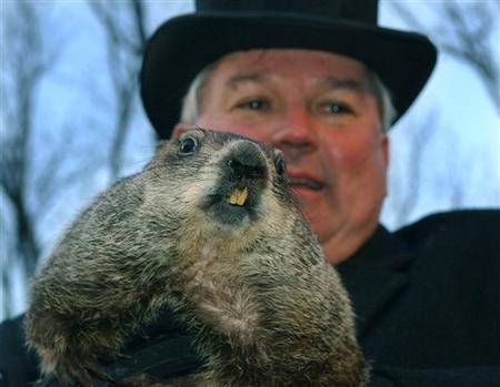
 Groundhogs are covered with coarse grayish hairs (fur) tipped with brown or sometimes dull red. They have short ears, a short tail, short legs, and are surprisingly quick. Their jaws are exceptionally strong.

 A groundhog's diet consists of lots of greens, fruits, and vegetables and very little water. Most of their liquids come from dewy leaves.

 A groundhog can whistle when it is alarmed. Groundhogs also whistle in the spring when they begin courting.


Friday, February 1, 2008

Ice, Ice, Baby

This song brings back so many memories. I highly advise you to press PLAY on the music video below, and then read the rest of this blog entry.....I'll wait...OK....All Done?
The forecast was on the money today. The freezing rain materialized as expected, and the amount of rain we got was so beneficial. We started 2008 with nearly a foot rainfall deficit, so we need to count on catching up this year. We get many questions about winter precipitation, especially freezing rain. It's probably the simplest of the precipitation, but often most confusing. Freezing rain is simply rain that falls from the sky, then freezes on contact on surfaces that are 32 degrees or below. Freezing rain and "ICE" can be used interchangeably.

Today we saw the ice mainly on trees and power lines and not on the roads. This is because the earth is a good insulator and retains heat well. Since the roads have been so warm lately, they never made it to 32, unlike the elevated surfaces which hit the freezing mark.

As of Noon Friday, here are some of the ice amounts from the National Weather Service:

VIRGINIA

...AMHERST COUNTY...
MONROE 0.20

...BATH COUNTY...
WARM SPRINGS 0.30

...BEDFORD COUNTY...
FOREST 0.25
THAXTON 0.20

...BLAND COUNTY...
BLAND 0.05

...BOTETOURT COUNTY...
BUCHANAN 0.25

...BUCKINGHAM COUNTY...
BUCKINGHAM 0.10

...CARROLL COUNTY...
CANA 0.30

...CITY OF BUENA VISTA...
BUENA VISTA 0.25

...CITY OF COVINGTON...
COVINGTON 0.25

...CITY OF GALAX...
GALAX 0.10

...CITY OF LYNCHBURG...
LYNCHBURG 0.25

...CITY OF ROANOKE...
ROANOKE 0.25

...CRAIG COUNTY...
PAINT BANK 0.25

...FLOYD COUNTY...
RINER 0.25 TREES DOWN
CHECK 0.30

...FRANKLIN COUNTY...
BOONES MILL 0.30
ROCKY MOUNT 0.25
FERRUM 0.20

...GILES COUNTY...
PEMBROKE 0.25 TREES DOWN

...GRAYSON COUNTY...
INDEPENDENCE 0.25 TREES DOWN

...HENRY COUNTY...
BASSETT 0.25

...MONTGOMERY COUNTY...
BLACKSBURG 0.30

...PATRICK COUNTY...
STUART 0.25 TREES/PWRLINES DOWN

...PULASKI COUNTY...
PULASKI 0.10

...ROCKBRIDGE COUNTY...
NATURAL BRIDGE 0.25

...SMYTH COUNTY...
MARION 0.10

...WYTHE COUNTY...
WYTHEVILLE 0.05

--Meteorologist Brent Watts

Tuesday, January 29, 2008

Groundhog Day Predictions


The big day is coming soon! Yep, can you believe it's already Groundhog Day (Feb 2)? If you're not familiar with what happens, here's the deal:

The official groundhog (also known as a woodchuck, marmot or ground squirrel) "Punxsutawney Phil" comes out of his burrow (glorified cage) the morning of Feb.2. He'll either see his shadow and run back in, or not see his shadow and run back in.

NO SHADOW: Look for an early spring

SHADOW: 6 more weeks of winter.

Obviously, it's more tradition than science. I mean, who would think a groundhog can predict the fate of winter better than a meteorologist? Let me re-phrase that question....

The tradition dates back the the 1800s and may derive from this Scottish poem:

As the light grows longer
The cold grows stronger
If Candlemas be fair and bright
Winter will have another flight
If Candlemas be cloud and snow
Winter will be gone and not come again
A farmer should on Candlemas day
Have half his corn and half his hay
On Candlemas day if thorns hang a drop
You can be sure of a good pea crop

I won't even begin the translation, because I don't speak Scottish (ha!). There have been many famous Groundhogs through the years. Here's a list from Wikipedia. I'd like to add at the bottom, "Petie" found under the weather deck last August. He predicted all our vegetables would be eaten before the end of the summer. Turns out...he was right.

Punxsutawney Phil found in Punxsutawney, Pennsylvania
Wiarton Willie found in Wiarton, Ontario
Staten Island Chuck found in New York City, New York
General Beauregard Lee, PhD found in Atlanta, Georgia
Malverne Mel and Malverne Melissa found in Malverne, New York
Brandon Bob of Brandon, Manitoba
Balzac Billy of Balzac, Alberta
Shubenacadie Sam of Shubenacadie, Nova Scotia
Gary the Groundhog of Kleinburg, Ontario
Spanish Joe of Spanish, Ontario
Sir Walter Wally of Raleigh, North Carolina
Pardon Me Pete of Tampa, Florida
Jimmy the Groundhog of Sun Prairie, Wisconsin
Octoraro Orphie of Quarryville, Pennsylvania

If you'd like to visit the official Groundhog day history site CLICK HERE. Otherwise, we all hope you have a Happy Groundhog Day! ---Meteorologist Brent Watts


Tuesday, January 22, 2008

Snow Rollers and Other Rare Finds

SNOW ROLLERS
How do you like your doughnuts? How about glazed in ice? While these interesting features look like giant doughnuts, the circular snowballs are better known as snow rollers.

Snowroller2Snow rollers form under very specific weather conditions. One requirement is a crusty layer of snow on the ground to which new snow will not stick. A light accumulation of loose, wet snow on top of the crusty snow can then roll up when blown by gusty winds that serve to scoop it up off the crusty layer.

As gravity pulls a clump down, it usually rolls down the hill and collapses. Sometimes it will not roll at all, and will come down in an avalanche of snow. But if the snow is the perfect density and temperature, it rolls down leaving a hole in the center.

The weather conditions have to be utterly perfect for the rollers to form. In fact, most go their whole life without ever seeing one.

The National Weather Service office in Lincoln, Ill., put together a nice webpage on snow rollers, with a nice formation explanation as well as photos of a snow roller event that occurred in Feb. 2003.

SUN and MOON HALOS
Halos are a group of optical phenomenon due to the reflection or refraction of solar light on ice crystals suspended in the atmosphere (cirrus clouds, thin snow, icy fog, blown snow). The basic halos take the form of circles around the sun, at 22° (more common and brighter) and 46°.

The ring around the Moon is caused by the refraction of Moonlight (which of course is reflected sunlight) from ice crystals in the upper atmosphere. The shape of the ice crystals results in a focusing of the light into a ring. Since the ice crystals typically have the same shape, namely a hexagonal shape, the Moon ring is almost always the same size.

Less typical are the halos that may be produced by different angles in the crystals. They can create halos with an angle of 46 degrees.

MOON RING FOLKLORE
Folklore has it that a ring around the moon signifies bad weather is coming, and in many cases this may be true. So how can rings around the moon be a predictor of weather to come? The ice crystals that cover the halo signify high altitude, thin cirrus clouds that normally precede a warm front by one or two days.

Ancient folklore says the number of stars within a moon halo indicate the number days before bad weather will arrive. I've also heard, if snow is coming, the number of stars within the ring will indicate the amount of snow (in inches) we'll get.

Give it a try the next time you observe a moon halo. Let me know how it turns out.

--Meteorologist Brent Watts


Monday, January 21, 2008

Life's A Beach!

Now that we've had a little bit of snow, I'm getting antsy for some beach weather once again. My neighbors just got back from a cruise where they went on a zip-line through a tropical rainforest.

So, to satisfy the cravings of beach-seekers in the middle of southwest Virginia winters, I propose we build an indoor beach. Perhaps like the one in Japan.

The Ocean Dome, the world’s largest indoor beach, Kyushu Island, Japan — 987 feet in length and 382 feet wide, with a height of 128 feet, it can accommodate 10,000 people.

A heated ocean sends 13,500 tons of salt-free water sweeping across 600 tons of polished marble chips that constitute a 278-foot long shoreline, ringed by a three-story promenade of shops. Every fifteen minutes, the volcano smokes to life. Every hour, on the hour, it spews fake flames. Now THAT'S what I'm talking about! 

The odd part is that people pay around $50 (American dollars) to go to the indoor beach, when there's a free one just a few hundred feet away.

We could build it on the site near the Roanoke Civic Center where the amphitheater was (then wasn't, then was, then wasn't) supposed to go. I think I'll send my proposal to the Mayor's office.

Jokes aside, it's a great design and if I had the money (and could speak Japanese) I'd like to go see it in person. Until then, I'll sit here in and look at the thermometer that says 14 degrees, and dream of lapping waves, sandcastles and bikini clad....

TO BE CONTINUED! MY WIFE WALKED IN. :)
Enjoy the cold weather
-Brent

Friday, January 11, 2008

Woolly Worm Not Far Off The Mark


Late last fall on Beyond the Forecast, I brought you the story of how the colors on the Woolly Worm (or caterpillar to be more accurate) have been used for years to predict the outcome of the upcoming winter.

So, after the official Woolly Worm was, umm, "crowned" in Banner Elk, North Carolina, I decided to keep track of the predictions and compare them to the actual conditions.

So far, the caterpillar is not doing well. Here's the breakdown for the first

Week 1
WOOLLY FORECAST: Cold and Snowy
ACTUAL: Showers & Seasonable

Week 2
WOOLLY FORECAST: Cold And Snowy
ACTUAL: Cold & Mtn. Snow

Week 3
WOOLLY FORECAST: Cold And Snowy
ACTUAL: Mild and Showers

Week 4
WOOLLY FORECAST: Cold And Snowy
ACTUAL: Cold And Snowy

Track the woolly worm's progress through the rest of winter.

Thursday, January 10, 2008

The Blizzard Of 1966

Winters in southwest Virginia are often unpredictable. It can feel like Miami, or even Maine all in the same week.All it takes is one big storm to change the perception of an a winter.

The winter of 1965-66 started out much like this winter. Only 1/2" of snow had fallen at the Roanoke Regional Airport through January 1st.The winter of 1965-66 was much like this year, only a half inch of snow fell before January 1st. The weather turned rapidly raw after the New Year. A blizzard struck Virginia and the Northeastern United States. It was the second snowstorm to hit Virginia in a week. At the same time snow drifts formed, arctic air was settling in dropping temperatures into the teens.

January 1966 ended up going down as Roanoke's snowiest on record with 41 inches.
On the other hand, the Roanoke Valley has been through winters with very little snowfall.
In the winter of 1975-76, only ONE INCH of snow fell in Roanoke. Below are some of the least snowiest years.We're getting all the ingredients for a major winter storm, cold air and moisture, but they just can't seem to coordinate their visit. Don't put away your sled just yet. There's always a chance.

The National Weather Service in Blacksburg has compiled data for southwest Virginia winters. Below you'll find some of the statistics.

Average Snowfall = 22.9 inches
Greatest Snow = 22.2 inches in Jan. 1996
Snowiest Month = 41.2 inches in Jan. 1966
Coldest Temperature = -11°F in Jan. 1985

Click video player below for raw film footage of the snow storm of 1966.